ECONOMY
States to get $2m each to accomplish GIS — NGF

States able to capture at least 50 per cent of their property that have electricity connections in urban areas before June 30, 2021 using Geographic Information Systems (GIS) will get World Bank’s $2million each.
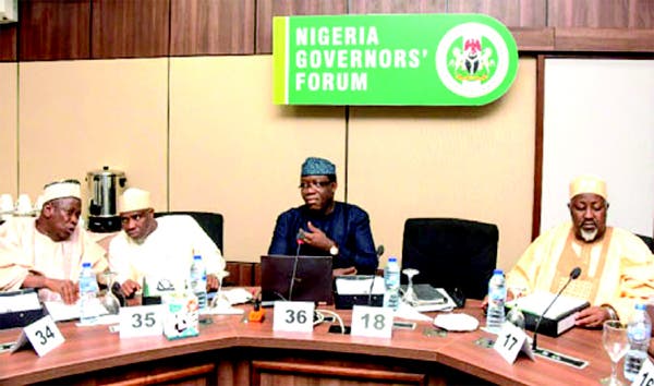
The Nigerian Governors’ Forum (NGF) disclosed this in a statement by its Head, Media and Public Affairs Mr Abdulrazaque Bello-Barkindo, in Abuja on Wednesday.
Bello-Barkindo said that the states able to update their property records would each unlock the performance grant under the World Bank-funded States Fiscal Transparency, Accountability and Sustainability (SFTAS) programme.
“However, it is imperative that these property records reflect accurate information about the name of the owner/occupier, size of the land parcel, size of the building, use of the land/property amongst other criteria required by the programme.
“It is no news that States are at varying stages of GIS deployment with some notably Kaduna, Kogi, Lagos, Oyo, Nasarawa, and Gombe States leading the way.”
In that development, Bello-Barkindo said that the NGF had scheduled two Virtual Peer Learning Events (PLEs) on “using GIS technology to strengthen land administration and property taxation” at the subnational level.
He said that the event would be held in collaboration with the Federal Ministry of Finance, Budget and National Planning assisted by the World Bank.
“The Peer Learning Events are part of several capacity building efforts aimed at supporting the effective deployment of GIS at State-level.
“Efforts are underway to provide States with GIS data, orthophotos of property mapping and software to support enumeration.”
Bello-Barkindo said that the peer learning events would have the states showcase their deployment experience.
He said that the event would also avail aspiring states still early in the process of deployment an opportunity to break free of challenges that could hinder GIS deployment at State level.
The event, according to Olanrewaju Ajogbasile, NGF’s Senior Program Manager, SFTAS Technical Assistance Project, will hold on Nov. 5, and Nov. 16.
Ajogbasile said that states were determined to get it right this time and ensure old mistakes were not repeated thus, “the need to learn from the experiences of others who have led the way in GIS deployment.”
“GIS deployment and the consequential benefit of holding accurate land and property records will bring sanity to land administration across the country while ensuring that fair and right taxes, fees or levies are charged.”
Ajogbasile noted that no fewer than 160 persons would be in attendance at both peer learning events including State actors, partners and implementing agencies on the SFTAS programme.
State officials expected at the event include states Project Managers for the GIS deployment; Directors of Lands (Ministry of Lands/GIS Agency); Directors, Property Tax (State IRS); and States SFTAS Focal Persons.


 Davido's Net Worth & Lifestyle
